Showing posts with label tropical storm. Show all posts

Wednesday, August 26, 2020

Hurricane Laura


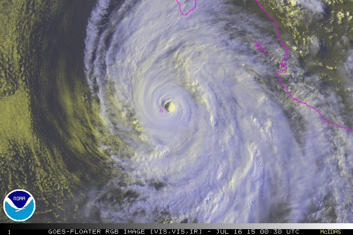
 This is Hurricane Laura. 

This is a meta-disaster.

This is a side effect of climate change. 

The idiocy of conservatives would have you believe the earth would even out and solve this on its own.

What utter bullshit. This storm went from a measly tropical storm to a category 4 tropical cyclone in a matter of hours. 

I feel for the people in the areas affected. A 20 foot storm surge. Whole towns under water. Fetid stinking water full of garbage and alligators and snakes and who knows what else. 

This will keep happening. The world is changing. This happened before in the Paleocene. Only this time it's not natural. It's because of we human apes destroy what we touch. No species deserves extinction but we do. Very much. Mount Toba didn't do it. Nor did the black plague, not even coronavirus. What will end us would be truly epic. 

But this post is about a terrible disaster affecting the area that needs it the least. I hope people heeded the warnings and evacuated. If not. God help them. 

Sunday, September 1, 2019

Hurricane Dorian

This is Category 5 Hurricane Dorian. It is making life in the Bahamas extremely difficult. No, forecast tracks take it skating off the East Coast of the US but environmental effects and the tides will cause flooding, tornadoes and other terrible things.


As the Earth heats up, these will become more common. Dangerous cyclones will cause mass destruction and kill people. 

I'm not going to get into a climate argument here. The facts are plain. 

There is an organized area of storms just off the West African coast. It is forecast to become a tropical depression very soon. No telling what it will do. 

Wednesday, September 12, 2018

Hurricane Florence

This beast is Hurricane Florence. It is a well-heeled tropical cyclone and has high winds, dangerous storm surge and prodigious rain. 

It's bad for people in the Carolinas. However, you want to live by the water, certain risks are possible. 


This storm is due to sit over the area for a few days, dumping feet of rain on the area. It won't be like Harvey was here but in ways, it'll be worse. 

I hope the people got out. I question the intelligence of those who stayed. 

These storms are going to get worse as the seas heat up. They are liable to form quickly, gather strength, conditions favorable for it to move hundreds of miles before threatening any land. 

I am well inland myself. I know it is always a danger every year. 

I am sad for those who will be affected by this monster storm. 

Monday, September 10, 2018

Trouble

This is a picture from the new GOES satellite. It shows big trouble in the tropical Atlantic Ocean. I am worried this will be a horrible time for people in the Eastern US. 

There's been a lot of tropical cyclone trouble in the Pacific. Japan has been hit hard and that will only get worse as the seas heat up.

If you say the temperature isn't rising or that people did not cause it, fuck you. You are stupid and willfully ignorant and may you suffer what you decry as a fake thing. 

I have studied the weather my whole life, I know something is changing. I can't say, I am no scientist but I know more than the average. 

I'll post a satellite picture of Hurricane Florence when it gets closer to the US. 

Friday, September 1, 2017

New Threat - Irma

This is a beast called Irma. It is out in the Atlantic Ocean. It is liable, but not certain, to pass between Cuba and Florida and enter the Gulf of Mexico.


The Gulf of Mexico is very warm. It breeds freakish and destructive storms like Harvey. 

What then? The last thing the US Gulf Coast needs is another destructive tropical cyclone. This is also true of Mexico or Central America, should it go that way. 

I will watch this one closely. I hope it doesn't pose a threat but then, all tropical cyclones are a threat. Especially that one that hit SE Asia recently. 

The Anthropocene. The stupid greedy apes refusing to change. We are reaping what they have sown. 

Friday, August 25, 2017

Hurricane Harvey

I normally appreciate the symmetry of a tropical cyclone. Some pictures of them are beautiful. 

They are usually in far away, tropical areas. 


However, I have watched this storm since it passed over the Yucatan Peninsula. At one point, it looked disorganized and may have not been much than a few thunderstorms. 

But it entered the Gulf of Mexico, which is about as warm as the ocean gets. It intensified, though looked disorganized. 

Now, the past few days, it began to take on the familiar swirly shape of a tropical cyclone and is now striking my homeland. I live 600 or so miles from the coast but even here, we will get prodigious amounts of rain from this.

I cannot stress the amount of rain that will fall on Texas. Some places in the Valley and near Interstate 10 will receive over a year's worth of rain and more, much more. More rain that has fallen in one place than ever. A storm surge of nearly 12 feet keeps flood waters from draining back to the ocean. 

The National Weather Service has said that some places may not be inhabitable for months, if ever. 

The storm now is bearing down on Corpus Christi, a place I have been a few times. I hope nothing is irreparably damaged. 

People mostly obeyed the evacuation orders but some stayed and did so to their peril. 

What makes matters worse, apparently this storm will make it up to the San Antonio area and then after a few days, make its way back into the ocean to strike Eastern Texas and Louisiana.

It is an epic disaster. I cannot believe this is happening. And while our area will receive some rain, nothing like down south. I hope no one is hurt. 


No, I have said before, storms are no light matter. Not even ones hitting where I live. 

I don't know what else to say. Just a huge disaster. 

Tuesday, October 4, 2016

Hurricane Matthew

I waited to talk about this storm but as you see, it is already destructive and dangerous. 


I hope people survive this storm but this is the first round of dangerous conditions, the Bahamas and the US east are next. First powerful cyclonic storm in several years in the Atlantic basin. Not something to admire. 

Saturday, February 20, 2016

Typhoon Winston

This is a rather powerful tropical cyclone called Winston. 

Those islands it is ravaging are in the Fiji area in the South Pacific.


The water is very warm in that part of the world. These monsters get going and cause immense damage and loss of life. 

I hope people are all right and the storm passes on quickly. Its forecast is to track westward and pass into cooler waters, where it will weaken and dissipate.

Wednesday, November 25, 2015

Hurricane Sandra

Late in the season, ends on Nov 30th, this cyclone formed in the east Pacific off Mexico. 


It is a fairly strong storm but is forecast to encounter shear and that will weaken it severely. It will hit Baja or the mainland coast of Mexico, bringing high winds and lots of rain. I reckon if you live by the ocean, you come to expect things like this. 

I dearly want to visit Baja one of these days.

I hope no one is injured or killed and property damage is minimal. 

I cannot say if this is the last tropical cyclone of the season. The weather doesn't obey human schedules. 

Friday, October 23, 2015

Hurricane Patricia

I remember Haiyan. Here is its little sister. Patricia is a monster, most severe tropical cyclone in this part of the world ever recorded. 


You know El Nino is behind it. Abnormally warm water in the Pacific. Like gas on a fire, it pumps energy into these monster storms. 

It will ravage parts of the Mexican coast and that is an awful thing, I hope people take precautions and get out. Those who can't, I hope they find a safe place.

Beyond this awful landfall, the sub-jet stream will push this moisture onto parts of my native Tx, where it might be needed but too much at one time is not a good thing. 

Patricia will go on into mountainous parts of Mexico and that will break up the storm, hopefully. You never know nowadays. 

Thursday, October 1, 2015

Hurricane Joaquin

I haven't talked about a storm now and in the latter half of Hurricane Season, I should talk about one. 


This beast is making life difficult in the Bahamas. it will sit in this area for a few days. That isn't good but what it does later, out to 5 days, is what worries many. 

It is liable or not to strike a densely populated part of the USA. Parts where it has rained a lot already. This beast is intensifying and by the time it hits or not, it could rival Sandy. 

No one wants that. I hope it heels off to the east in the North Atlantic like some models suggest. Won't know until it actually moves. 

I hope no one is hurt. 

Wednesday, July 15, 2015

Typhoon Nangka

This is Typhoon Nangka about to ravage the islands of Japan with big winds and massive amounts of rain. 


I would imagine it is always a concern when one is from or lives on islands vulnerable to tropical cyclones, preparation is automatic. 

I hope no one is hurt but things happen. It feels wrong to admire the storm's structure when it threatens such a populated area.  

Hurricane Dolores

Time to talk about tropical storms again. Been a while. 

This is Dolores, in the Eastern Pacific. It has caused some problems.


It is moving northwest and should not be a factor as it moves into colder water which tropical cyclones do not like. 

Saturday, April 4, 2015

TS Haishen

I haven't discussed a tropical storm in a long while. There have been several in the Pacific and Indian Oceans.


Hurricane season here starts on the first of June and runs to the end of November.

This one is in the mid-West Pacific and heading north of the Philippines, which just was hit by Typhoon Maysak, which isn't very photogenic now.

Conditions for this tropical storm are unfavorable so, hopefully, it will dissipate before causing too many problems. That is good.

Friday, December 5, 2014

Super Typhoon Hagupit

This beast is hitting the Philippines as I write this. 150+mph winds and rain like a deluge.

I don't like storms that hurt people.


I like Filipino people, my first gf was Filipina. I don't want anyone to get hurt by this cyclone but it always happens. I can't say what life's like there. Never been there.

This storm will pass over the islands and continue on to northern Indochina or even China, weakening before it hits as it encounters shear.

I will hope no one is killed by this storm. It is late in the year to feature a storm like this but the weather never stops.

Wednesday, October 15, 2014

Hurricane Gonzalo

This is Category 3 Hurricane Gonzalo.

It is in the Atlantic Ocean, those islands in this picture being the Bahamas and Hispaniola.

It is heading north-northwestward at 5 mph, about to be deflected by a trough in the Eastern USA. That will put it on a more northerly track and cause it to come close to or hit the island of Bermuda.

The eye is fluctuating, causing the intensity of this cyclone to fluctuate. It will soon pass into drier air and over sharply colder water within a few days, becoming extra-tropical.

I am sorry it is not a beautiful RGB image. The RGB feed had a sharp distortion in it.

I hope Bermuda is spared the worst and no one is hurt.

Saturday, October 11, 2014

Typhoon Vongfong

This is dangerous Typhoon Vongfong ravaging Okinawa now and is heading to Japan.

I don't like cyclones that harm people.


Its swirly beauty is ruined by that, actually.

I have not forgotten, I just didn't post tropical cyclone pictures because I was feeling bad. I hope Vongfong doesn't kill anyone and damage is limited.

Sunday, September 14, 2014

Hurricane Edouard

Another tropical cyclone to mention on this Hate Sunday.

This dramatic picture is of Edouard, Category 1-ish, in the Atlantic.


It is forecasted to strengthen in the next few days.

This storm will be deflected from the USA by an atmospheric trough and will cross the Atlantic, get caught up in the Westerlies, accelerating and becoming extratropical. It will eventually pass over cold water and dissipate.

What is with these funny names? I guess the good ones are already taken.

Hurricane Odile

This is a beast of a cyclone. Odile, in the Pacific, just south of Baja California.


Category 4, strength has leveled off and it has a double eyewall, which can cause intensity to fluctuate.

It will go parallel to Baja, buffeting its west coast with heavy rain and big winds. I hope people take precautions as I write this.

The danger isn't just from the wind, extremely heavy rains can cause flash flooding which always creates problems.

This storm will pass into drier air and colder water, which are harmful to a tropical storm. After dissipation, it will cause heavy rain in the American Southwest, hopefully in California where they need it so.

Saturday, September 6, 2014

Hurricane Norbert

This is Hurricane Norbert, Category 3, off the coast of Baja. It is a powerful storm but it is weakening as I write this, crossing into cooler waters.


It is forecasted to weaken and join upper level ridging over Northern Mexico and the American Southwest, creating heavy rain with its remnant moisture. It can't come to Texas, can it? We need
the rain.

It makes for a swirly picture of a tropical cyclone, something to appreciate on an otherwise unhappy day.